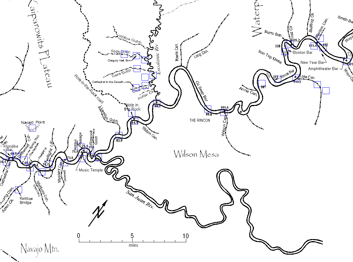
| Lower Section Map |
River miles are measured from Lees Ferry, 15 miles below the dam. These are not reservoir miles. |
| .
. . .
. . . |
| Click near the edge of the map to go to the adjacent map |
Click near the edge of the
map to go to the adjacent map
|
|
| Click near the edge of the map to go to the adjacent map |
Click near the edge of the
map to go to the adjacent map
|
| November
14, 2006: All three maps are posted and are being upgraded.
Most of the pictures were taken on about a dozen exploratory trips into Glen Canyon between 1961 and 1964. The explorations were systematic, guided by the library resources of U. of California, Berkeley. They involved a total of 77 different people from the Berkeley community, some of whom were on all trips, some on only one. |
Flooding
sequences will be added now and then.
The pictures are from a collection of thousands. About 600 have already been scanned for possible use here and in new videos now being prepared. We would like to see pictures of others also posted to the Web and interlinked into a Web ring. Any takers? |