June, 1964
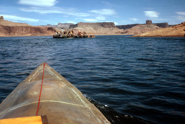
| June, 1964 Mile 38.3 We--one of the noisest boats on Lake Powell because we have just discovered that if we open the throttle wide on our 3-1/2 HP motor-driven kayak catamaran, we will plane on the surface, go a lot faster, and save a lot of gas--are approaching the Sierra Club raft heading toward the Escalante River and Cathedral in the Desert. |
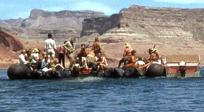
| Enlargement of above photo. The standing man on the left with a dark hat is David Brower, director of the Sierra Club. To his right, fiddling with his Sierra Club cup is Dan Luten, a chemist with the Geography Department at U.C. Berkeley. Below him, fiddling with the motor is Richard Norgaard the organizer of the raft trip and graduate student at Berkeley (later to become a faculty member in the Economics Department). The person with the camera taking a picture of us taking a picture of him is Terry Russell author, with his brother Renny, of "On the Loose." Sitting in a red shirt and facing to the right is Barbara Brower, daughter of David (currently Professor of Geography at Portland State University--Oregon). Facing her, with a feather in her cap is Nancy Eberle. Walter Edwards, photographer from National Geographic doing a photo shoot of Glen Canyon for his magazine, is somewhere on this raft, possibly in the khaki shirt near the far left. Phil Hyde, who took the well-known photo of Cathedral in the Desert, and made several of the Sierra Club books, is somewhere on the raft heading for that shot in Cathedral in the Desert. |
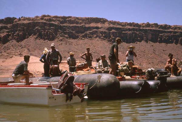
| mile 100.6 Richard Norgaard on the far left in motor boat. Phil Hyde, floppy tan hat, standing and facing us with his wife, Ardis, behind him and facing away from us. Next, standing and no hat, is Terry Russell. Sitting with red feather in hat, Dan Luten. Standing to his right is Bob Brower, son of David. Sitting at the far right with the dark hat, Ken Brower, son of David and author of "The the Starship and the Canoe." |