|
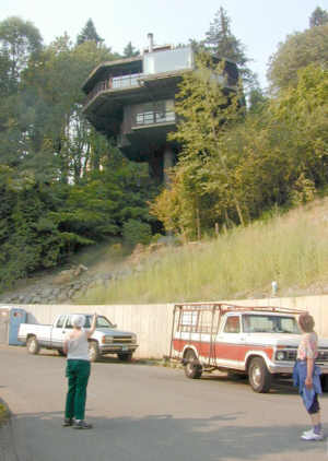
Parking
Parking for this loop
is at the Marquam Nature Park Shelter at the end of Marquam St, which is
a short dead end street at the first sharp turn on Jackson Park Rd, the route from Terwilliger up to OHSU. Look here for maps and pictures. Alternative
parking is on Broadway Dr at the top of the trail up from Sunnyside Trail
and on Fairmont Blvd at the top of Sherwood Pl -- both for
no more than one or two cars.
The Route
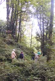 Immediately above the shelter (elevation 250')
an old, paved street extends up the south (left) side of the gulch
where you can see the remains of three houses which were occupied in the
years before Marquam Nature Park. Sunnyside Trail goes to the right
near the cable that blocks auto access to the old homesites. The route
immediately starts climbing after crossing the gulch, and it climbs steadily
all the way to Broadway Drive (elevation 640').
Broadway trail is the trail at the stairs above the bench -- Sunnyside Trail
continues up the main gulch but drops a little just beyond the intersection
with Broadway Trail. (It is one route to Council
Crest.)
Immediately above the shelter (elevation 250')
an old, paved street extends up the south (left) side of the gulch
where you can see the remains of three houses which were occupied in the
years before Marquam Nature Park. Sunnyside Trail goes to the right
near the cable that blocks auto access to the old homesites. The route
immediately starts climbing after crossing the gulch, and it climbs steadily
all the way to Broadway Drive (elevation 640').
Broadway trail is the trail at the stairs above the bench -- Sunnyside Trail
continues up the main gulch but drops a little just beyond the intersection
with Broadway Trail. (It is one route to Council
Crest.)
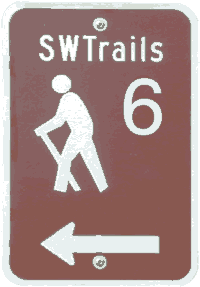 At Broadway Drive,Trail #6 to the north
goes up the stairs across the street, and to the south goes up Broadway Drive
a short distance to Edgewood Dr and Sherwood Drive. We take Trail #6
to the south: a block of Broadway Dr, then veering up to Sherwood Dr.
Look for the signs. Follow Tr #6 all the way to Fairmount Blvd (elevation 850') and then to Marquam Hill Rd, but note the
shortcut a little before the intersection of Sherwood Dr and Sherwood Pl.
At Broadway Drive,Trail #6 to the north
goes up the stairs across the street, and to the south goes up Broadway Drive
a short distance to Edgewood Dr and Sherwood Drive. We take Trail #6
to the south: a block of Broadway Dr, then veering up to Sherwood Dr.
Look for the signs. Follow Tr #6 all the way to Fairmount Blvd (elevation 850') and then to Marquam Hill Rd, but note the
shortcut a little before the intersection of Sherwood Dr and Sherwood Pl.
 Take Trail #1 down Marquam Hill Rd but watch for
the Marquam Gulch Trail (upper branch of the Forty-Mile Trail)
to the left, 220 yards down from the intersection. Stay on the trail,
taking the branch to the left just before the branch to the right drops downto
the creek bed. This puts us on the Dan & Rusty Goldy Corridor trail
(a memorial plaque-on-a-rock is located just below Sherwood
Dr on the main trail) A very large poison ivy vine has been growing
on a tree about 15 yards to the right of the trail, at a point directly below
the dead end of Sherwood Dr--on the above map it's right on top of the "R"
in the word "NATURE.". (Very close to the vine, there's an
illicit trail up to the house at the end of Sherwood Dr.)
The route turns to the west as it rounds the ridge and eventually comes to
the intersection with the main trail which takes us back down to the shelter.
Take Trail #1 down Marquam Hill Rd but watch for
the Marquam Gulch Trail (upper branch of the Forty-Mile Trail)
to the left, 220 yards down from the intersection. Stay on the trail,
taking the branch to the left just before the branch to the right drops downto
the creek bed. This puts us on the Dan & Rusty Goldy Corridor trail
(a memorial plaque-on-a-rock is located just below Sherwood
Dr on the main trail) A very large poison ivy vine has been growing
on a tree about 15 yards to the right of the trail, at a point directly below
the dead end of Sherwood Dr--on the above map it's right on top of the "R"
in the word "NATURE.". (Very close to the vine, there's an
illicit trail up to the house at the end of Sherwood Dr.)
The route turns to the west as it rounds the ridge and eventually comes to
the intersection with the main trail which takes us back down to the shelter.
|

 Mt Hood as seen from this route
 Posion Ivy