Watch for the complete set of questions.
What mountains can you see from Council Crest?

What mountains can you see from Council Crest?

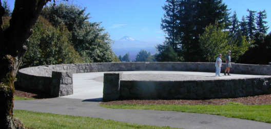
| A rock wall rings the summit of Council Crest. Stand on the brass
cap in the middle of the ring, and your voice will come back to you as
an amplified echo.
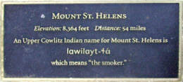
You can also see plaques in the rim of the wall that point you to the four big volcanos of the nearby Cascade Mountains |
 |
|
 |
|
 |

 Mt St. Helens to the north, and just a little to the left is Mt Ranier,
the highest peak in the Cascades.
 |
 |
Before the rock-ring wall was rebuilt, there was another plaque pointing to another big volcano, this one to the south.. It is Mt. Jefferson. A tree has grown up to block the view of Mt. Jefferson from the ring. However, you can leave the ring, walk several yards to the west and peek through a hole through the trees. There, just to the right of one of the transmission towers on Healy Heights is Mt. Jefferson. |
|
The many trails to Council Crest: the 40-mile trail which comes from the north from the Zoo and from the southeast from the Terwilliger bike and running path; the three designated trails of the Southwest Trails Plan that pass within a few hundred yards of the summit; the "Coyote" trail to Fairmount Blvd that runs along a string of Water Bureau meters (and once had a sign "Coyote Crossing" at one end in honor of a resident wild coyote). Discover the story portrayed along the outer edge
of the cobbled circle in the rock ring on Council Crest. See the
old trolleys and the amusement park by following the links in the Oregon
Historical Society "City Views" Web presentation. (You
click on maps to narrow down to the location you want to see. Click
on SW Portland, then continue selecting neighborhoods to narrow you down
to Council Crest.)
|