Kelly Park - Fairmount Blvd - Dosch Estates
a walking/running route
3.48 miles (3.41 miles)
Higest elevation: 920' on Wapato.
Lowest elevation: 295' at 39th & Fanno Ck

A hilly route with beautiful gardens and magnificent architecture in out-of-the-way  places.  The route generally avoids busy streets, except for a couple of short bits on Dosch Rd and another on Hamilton.  A good place to start is Albert Kelly park where parking is plentiful along bordering streets, especially along Boundary St. Note:  The Melville-Twombly connector path is along unmarked driveways at both upper and lower ends.  Future trail signs will (soon) mark these critical turn points.
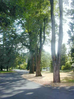
1. Looking south from Dosch House

1.  Looking north at Dosch House
Two of the trees by Dosch House
2.  Walking east on Bancroft, approaching Jerald


Lower end of Water Bur Trail at Martins Ln.
Watch carefully for it--it's easy to miss.

The Water Bureau trail is often called "The Coyote Trail" because a sign used to be posted at its bottom, "Warning, Coyote Crossing."  The pair of coyotes became threatened by neighbors who suspected the coyotes in the loss of some pet cats, so concerned citizens dropped mention of coyotes in the neighborhood -- for the general good of all the animals.


3.  Water Bureau easment trail
Martins Ln to Fairmount Blvd
 See SWTrails Project
4.  Stairs to Chesapeake Ave
About half of this loop is on Trail #1 of the SW Urban Trails Plan (map)-- from the corner of Chehalem and Wapato, down the Chesapeake stairs and Melville-to-Twombly path, through Dosch Estates, Dosch Rd, Mtichell St, and into Kelly Park, and then to 39th and Lee, where Trail #1 goes west over the new stream crossing path to 42nd.
 
Trail #1 is the next Urban Trail Plan trail scheduled for trail signs.   Watch for them.

The trail signs were installed Fall, 2003.

Trail #1 crosses SW Barbur Blvd at SW Whitaker St