The original April, 2006
web posting:

|
The first phase of the Web presentation of many of our photos of Glen Canyon before Lake Powell is complete. These are currently indexed on three maps -- on the maps, click on the blue squares to link to photo pages at those locations. |
central map lower map Each individual photo page has links to nearby pages. The picture pages will be further sorted and added to, and will show many sequences with various stages of innundation. (November 15, 2006: There are now several of these sequences. Look for links labeled "The next two years," or "See the reservoir move in," or something similar.) |
The original April, 2006
web posting:

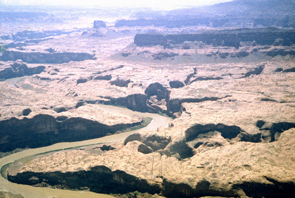
| June, 1961 Taken on a search
flight looking for two lost
hikers. A group of 13 from UC, Berkeley were seeing the big canyons
of Glen for the first time.
The San Juan River enters the Colorado River at the bottom left of the photo. Cottonwood Gulch (Reflection Canyon--featured in the Jul/Aug, 06 Audubon Magazine) is on the other side of the ridge from the Colorado in the foreground. Hidden Passage is in the center of the photo. |

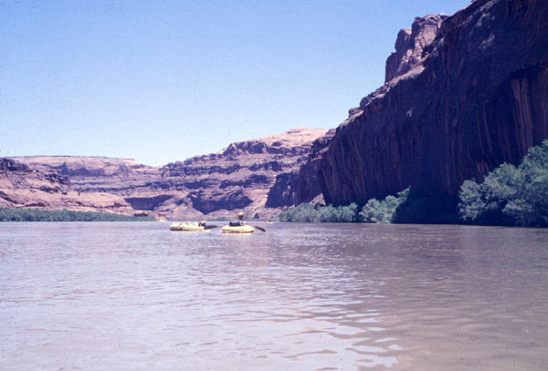
June, 1962 Mile 140.5 Glen
Canyon on the first exploratory float trip by river of several groups from
the University of California at Berkeley. Seventy-seven different
people had participated before the reservoir closed in and made impossible
these truly extraordinary explorations. The most stunning side canyons,
with their staggeringly gigantic stream alcoves were innundated.
Some upper canyons remain, but few of them can hold a candle to what went
under.. (What's left are still among the most spectacular canyons
in the world. (See John Hart's spectacular
websiste.) The leisurely, almost wind-free floats protected by
high canyon walls are gone. The springs that provided fresh,
sweet, drinking water are gone. Much of the wildlife is gone.
The adventure of exploring a remote, virtually unknown wilderness is absent.
The numerous river-level Anasazi sites are gone. The spirit of the
Anasazi left when their ancient home setting was destroyed.
Sylvia Tone (Toni--age 70), a frequent traveller with Georgie White in Glen and Grand Canyons wrote this about a trip to Lake Powell, soon after Glen was gone:"Last spring, I made the mistake of taking the boat trip on Lake Powell, to what were once Aztec and Bridge Canyons and walked to Rainbow. We were herded along by the guides like a bunch of sheep, not allowed to leave the trail or go to the little cottonwood and spring under the bridge. I was more than depressed and told my friends. Powell was a dead world. Deadness is the only word that describes it. Not a flower or a leaf or tree or little lizard, and being old and emotional and sick at heart, I cried." |

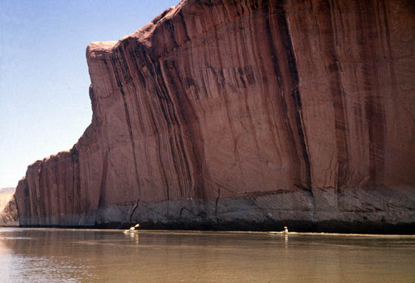
| Mile 42.5 Glen Canyon and this trip is nearly over. Crossing of the Fathers and the cars to take us home lie just a few miles ahead. Everybody stops talking and paddles almost not at all. We know we may never again experience what has so thoroughly captivated us since we put our boats in at Hite, 120 miles back. |
A little incidental information:
| In 1962-3, with cinematographer
Larry Dawson of Palmer Studios, San Francisco, and under the direction
of David Brower, Sierra Club, I provided photography, script, and passion
to produce one of the Sierra Club film series, Glen Canyon. It was
for years, the most screened of the series, and it won an award at the
San Francisco Film Festival for 1964.
This film was made from a multimedia production that I had made to show the Sierra Club when I realized that the Sierra Club book, The Place No One Knew, was not going to make public the Glen Canyon our explorations had discovered. Our Glen Canyon slides number in the thousands. We have made digital scans of many of the best. We have just made a pilot DVD version of the original multimedia presentation from which the film was made. That original film is now hard to find (more than fifty copies have drifted into oblivion), We hope to convert the pilot into a modern version which will go beyond the goals of the original. Glen canyon has a peculiar history as well as a stunning, irreplaceable history of adventure. We aim to show the world something almost nobody knew, pre-1962 Glen Canyon. And we haven't much time (I'm under home hospice care with invariably-fatal pulmonary interstitial fibrosis), We will do what we can, and I am hoping others can pick up when I must leave the effort. Phil Pennington
November.14, 2006: Still here and the fibrosis has stabilized; but I'm slowly getting weaker. The pilot video (DVD) is completed, and the first phase of the web presentation is now posted on the Web and being added to as I find time. |
More:
Slot canyons & Gregory The digital scans are about 4000 X 6000 pixels. The photos on these pages are 600 pixels in the longer dimension. (July 31, 2006) I've made a new map of Glen Canyon as it was up to 1963, before Lake Powell formed as it drowned almost all of the glory of Glen Canyon. We've scanned about 600 35-mm slides and will place many of them on this Web site, indexed through the map. The map is provisional: we haven't yet located our detailed maps and trip logs. Lower Glen
Canyon
The video uses the sound track from the original slide show and the original slides, augmented with many other slides not used in the 1963 production. Previously on our websites:
|